Towards sustainable flood management: progress on the first Danube Flood Risk Management Plan

Towards sustainable flood management: progress on the first Danube Flood Risk Management Plan
With floods a serious threat in the region, the ICPDR is making progress on the first-ever basin-wide plan to manage flood risks for the entire Danube River Basin.

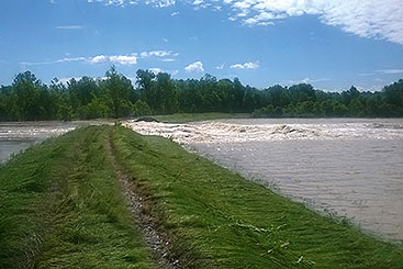
The Floods Directive requires flood hazard and risk maps showing the potential adverse consequences associated with various flood scenarios – pictured here, embankments in the area of Posavina, Bosnia and Herzegovina damaged by the recent floods.
© Agency for the Water District of the River Sava, Bosnia and Herzegovina
The Danube has been the site of many disastrous floods over the centuries. The most famous was the 1501 flood on the upper Danube, considered to be the largest summer flood of the last millennium, causing extensive devastation down to Vienna, and its impact felt downstream to the Danube Bend at Visegrád. An ice-jam-induced flood of 1838 devastated a number of settlements from Esztergom to Vukovar, including the towns Pest, Óbuda and the lower parts of Buda on the territory of today’s Hungarian capital. In recent years, major floods have occurred in 2002, 2006, 2010, 2013 and 2014.
From its beginnings, the ICPDR has made flood prevention a priority, and was recognised as a threat in the Danube River Protection Convention when it was first signed in 1994. Ten years later, the ICPDR adopted the Action Programme for Sustainable Flood Prevention at the ICPDR Ministerial Meeting on 13 December 2004. Under the Action Programme, the ICPDR published 17 sub-basin flood action plans in 2009. The sub-basin plans were based on 45 planning documents covering the entire basin and provided the first ever comprehensive overview of actions to reduce flood risk in the Danube Basin.
At the same time, similar efforts were under way at the European level, and the EU Floods Directive entered into force in 2007. The Directive requires Member States to carry out a preliminary flood risk assessment by 2011, draw up flood hazard and risk maps by 2013 and establish flood risk management plans focused on prevention, protection and preparedness by 2015.

Involving stakeholders is vital to the the future of flood protection, and preparation for the Flood Risk Management Plan for the Danube River Basin District will include a public consultation process.
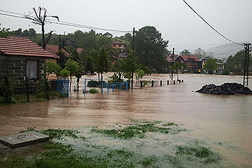
© Agency for the Water District of the River Sava, Bosnia and Herzegovina
In 2010, all of the Danube countries, even those that were not EU Member States, pledged to make all efforts to implement the Floods Directive throughout the entire Danube River Basin. At the ICPDR Ministerial Meeting in 2010, Danube Ministers adopted the Danube Declaration, which included, among other things, a commitment to develop a single international Flood Risk Management Plan by 2015. This plan will be based on the ICPDR Action Programme for Sustainable Flood Protection as well as the sub-basin plans, and will make full use of the existing synergies with the Danube River Basin Management Plan.
Gathering the tools for flood risk assessment. Receiving this mandate, the flood specialists working in the ICPDR Flood Protection Expert Group have taken all efforts to fulfil the requirements of the Floods Directive. The ICPDR carried out a Preliminary Flood Risk Assessment (PFRA) for the Danube River Basin District by March 2012. The PFRA report provided information on major past flood events and summarised the methodologies and criteria used at the national level to identify and assess floods that occurred in the past and their past adverse consequences. The report also reviewed the assessment at the national level of the potential adverse consequences of future floods for human health, the environment, cultural heritage and economic activity as well as the methodologies used at the national level to identify areas of potential significant flood risk, especially those of a transboundary nature. The map of these areas was updated in December 2013 with additional data.
The PFRA report produced by the ICPDR laid the foundation for the development of flood hazard and risk maps and for the preparation of a flood risk management plan. Most importantly, it provided the first ever overview of the areas of potential significant flood risk in the Danube River Basin District, therefore serving as a vital message to stakeholders and the public about the potential vulnerability to flood hazards.
The Floods Directive requires flood hazard and risk maps showing the potential adverse consequences associated with various flood scenarios, including information on potential sources of environmental pollution as a consequence of floods. These maps are necessary as an effective tool for information, as well as a valuable basis on which to set priorities and make further technical, financial and political decisions regarding flood risk management. The ICPDR is preparing the flood hazard map for the Danube River Basin District showing the extent of floods with medium and low probability for catchments larger than 4000 km2. A number of flood risk maps are also being prepared showing the impacts on population, economic activity, installations identified by the EU Integrated Pollution Prevention and Control Directive as well as protected areas under the EU Water Framework Directive.

The ICPDR report on Preliminary Flood Risk Assessment for the Danube River Basin District provided the first ever overview of the areas of potential significant flood risk in the Danube River Basin District, therefore serving as a vital message to stakeholders and the public about the potential vulnerability to flood hazards. © Agency for the Water District of the River Sava, Bosnia and Herzegovina
Basin-wide flood risk management objectives. The ICPDR is also currently under way on the Flood Risk Management Plan for the Danube River Basin District, which is setting appropriate objectives for managing flood risks for the entire river basin. The plan, due in 2015, will complement national flood risk management plans, which provide more detailed information on measures as well as flood maps. The ICPDR has agreed on the following basinwide objectives of the Flood Risk Management Plan: avoiding new risks; reducing existing risks; strengthening resilience; raising awareness; applying a principle of solidarity by not pushing problems downstream.
The Flood Risk Management Plan for the Danube River Basin District will focus on strategic level measures. While Danube flood experts are still discussing the final criteria to prioritise these strategic measures, it is clear that transboundary effects and a principle of solidarity should play a central role in selecting the most significant measures at the Danube Basin level. This would bring into focus measures such as natural water retention, flood retention, flood warning and monitoring systems, the reduction of risk from contaminated sites in floodplain areas and the exchange of information.
Planning for a green Danube. All flood retention structures contribute to flood attenuation, so will be given top priority in the plan. Similarly attention will be given to the green infrastructure measures which play an important role in sustainable flood risk management because they also act in favour of the environmental objectives of the EU Water Framework Directive. Finding ways to achieve common synergies and shared benefits is one of the stipulations of the Floods Directive, which requires countries to coordinate the implementation of that Directive with the EU Water Framework Directive. Therefore, making space for rivers, especially in areas where the human and economic stakes are relatively low, is a more sustainable way of managing floods and mitigating the potential future impacts of climate change. In addition, the conservation and restoration of the natural functions of wetlands and floodplains, with their ability to retain floodwaters and reduce the flood wave, can be seen as a winwin solution. For more about natural water retention measures, see article on page 12.
Involving stakeholders in the future of flood protection. All efforts are being made to produce a draft of the Flood Risk Management Plan for the Danube River Basin District by the end of 2014 in order to launch the public consultation process. This will be followed by the development of an updated version of the draft plan based on additional data collected early in 2015. The updated draft will be discussed at a stakeholder conference in June 2015 in the final phase of a seven-month public consultation period, which will end in July 2015. This approach will ensure that the first Flood Risk Management Plan for the Danube River Basin District will include all necessary information and ensure the active involvement of all interested stakeholders.


